Pine Hill Park, Carriage Trail and the Redfield trails offer an extensive network of trails to ride in Rutland, VT. There are a wide variety of trails for all types of riders.
Maps can be found here. Printed maps for Pine Hill Park are available at the front entrance kiosk at 2 Oak St. Extension in Rutland.
Mountain Biking Loops
Beginner: 2.1 Miles
(1) Escalator, (9) Svelte Tiger, (17) Sisyphus, (20) Watkins, (22) Svelte Tiger, (9) Escalator (1)
Advanced Beginner: 2.4 Miles
(1) Escalator, (9) Svelte Tiger, (22) (right on) Watkins, (23) Voldemort, (16) Birches, (15) Trillium, (17) Sisyphus, (20) Evergreen Fall, (18) Furlough, (9) Escalator (1).
Intermediate: 5.2 Miles
(1) Escalator, (9) Svelte Tiger, (22) Droopy Muffin, (26) Underdog, (32) Shimmer, (37) Overlook, (30) PA4J, (34) Strong Angel, (22B) down Jersey Turnpike, (25A) Annex, (36) Sore Elbow, (25) Rembrandt’s, (20) Evergreen Fall, (18) Furlough, (9) Exit Strategy.
Advanced Intermediate: 5.9 Miles
(1) Escalator, (9) Svelte Tiger, (17) Trillium, (15) Birches, (16) Vista, (24) Upper Ledges, (26) Droopy Muffin, (30) Overlook, (37) Shimmer, (32) Underdog, (26A) Salamander, (30) PA4J, (28) Lonely Rock, (25) Rembrandt’s, (20) Watkins, (38) Halfpipe, (40) Furlough, (9) Exit Strategy
Advanced Intermediate with more sustained climbing: 6.9 Miles
(1) Escalator, (9) Furlough, (18) Evergreen Fall, (20) Rembrandt’s, (25) Lonely Rock, (28) PA4J, (30) Overlook, (37) Stegosaurus (more technical), (34) Strong Angel, (22B) up Jersey Turnpike, (30A) down Droopy Muffin, (26) Upper Ledges, (24) Vista, (16) Birches, (15) Trillium, (17) Sisyphus, (20) Watkins, (38) Halfpipe, (40) Furlough, (9) Exit Strategy.
Carriage Trail
5.1 miles from the Giorgetti Trailhead to Proctor.
This route has a significant hill in the middle.
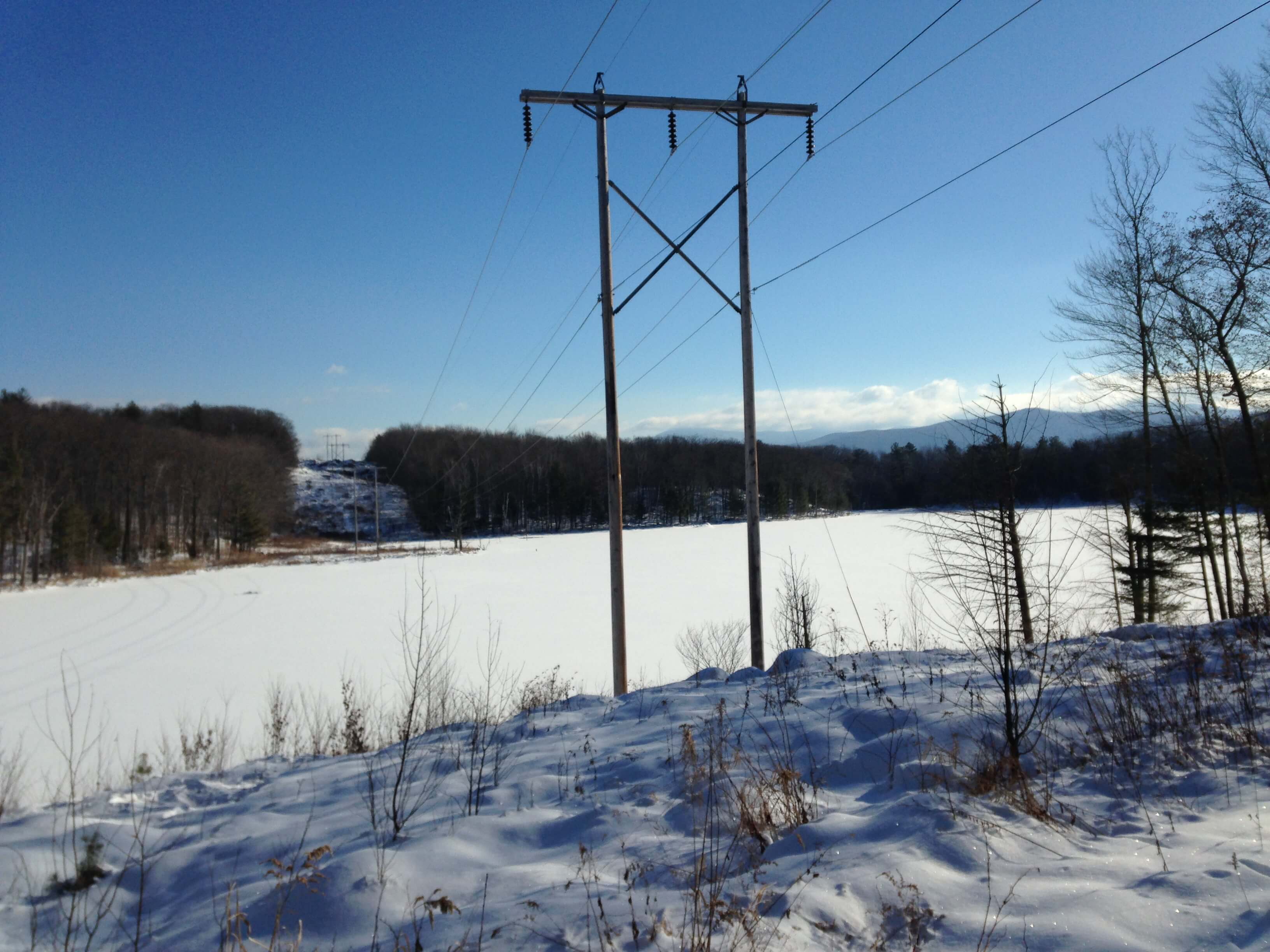
Stunning view from the powerline over looking Muddy Pond towards Blue Ridge and Pico to the east. This is prior to steep hill in the middle on the Rutland side.