
Directions to Pine Hill Park
Maps to Download

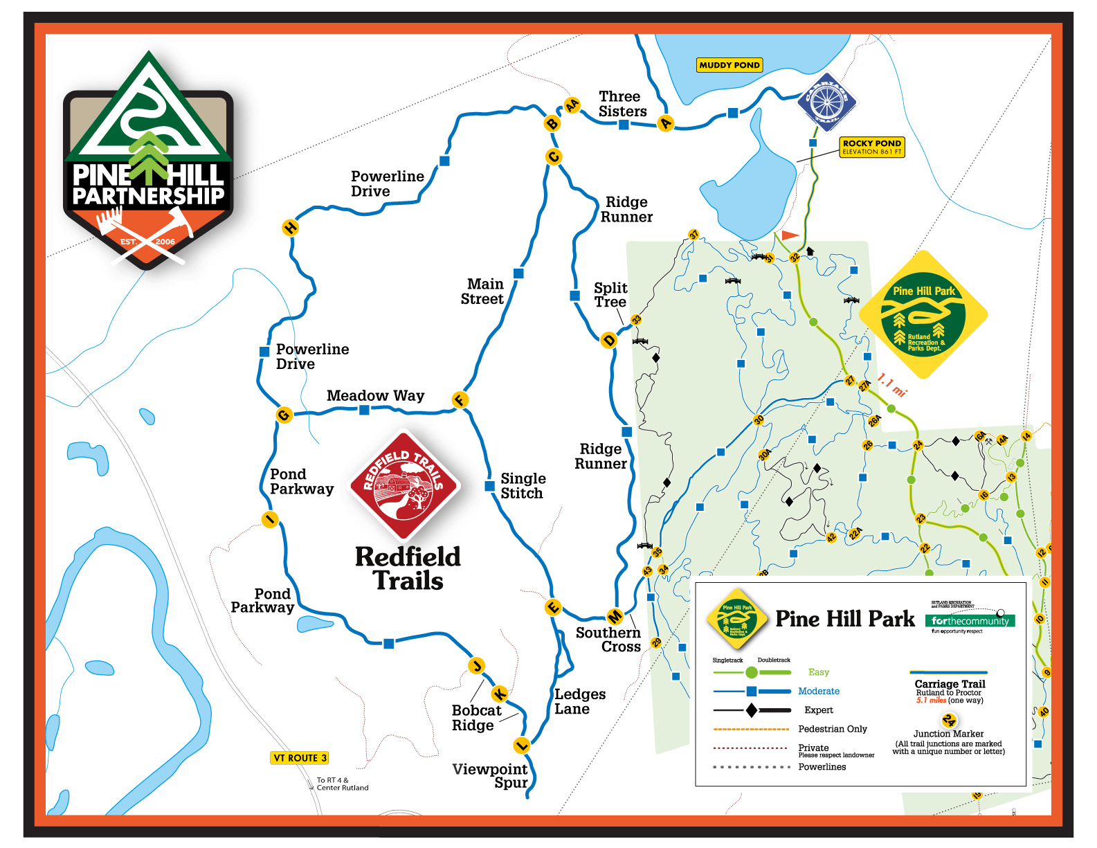
Download a Low Rez Pine Hill Park Map
(1.3mb PNG; opens new tab)
Download a Printable Pine Hill Park Map
( 2mb PDF; opens new tab; Print 8×11 Landscape)

Download a Printable Carriage Trail Map
(2mb PDF; opens new tab; Print 8×11 Portrait)
Download Carriage Trail Distances Table
(62kb PDF; opens new tab; Print 8×11 Landscape)

Download a Low Rez Redfield Trails Map
(141kb PNG; opens new tab)
Download a Printable Redfield Trails map
(994kb PDF; opens new tab; Print 8×11 Landscape)
Find our trail system on the following mobile apps:
https://app/public.trailfinder.info/trails/trail/pine-hill-park
https://app/public.mtbproject.com/directory/8010641/rutland
http://app/public.trailforks.com/region/pine-hill-park-12112/
For up to date trail conditions please check TrailHUB.org.
Conditions can change daily in fall, winter and spring.
Set Pine Hill Park as a favorite to receive up-to-date messages.
http://app/public.trailhub.org